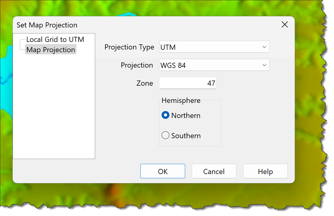
Set a UTM Map Projection, which is required to export KML (Google Earth) files.
To set a Map Projection:
•Click Survey > Set Map Projection to set the map projection.
•Set the:
oProjection type
oProjection
oZone
oHemisphere
•If necessary, enter Local Grid to UTM Projection translation and rotation parameters.
oTranslation:
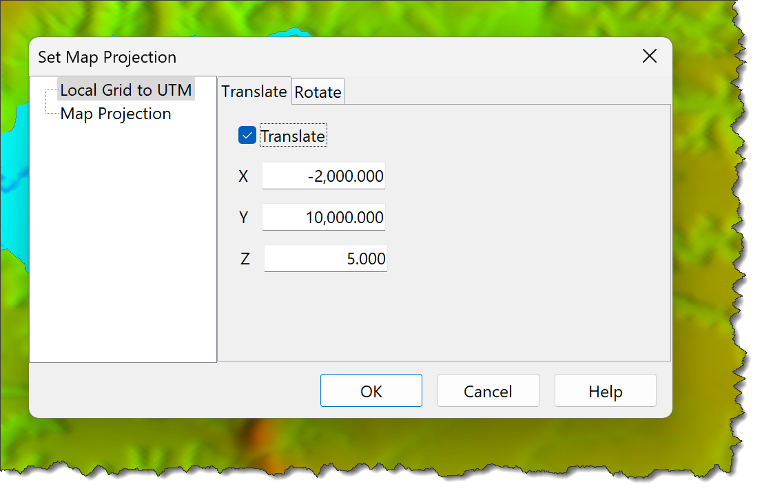
▪X Translation
▪Y Translation
▪Z Translation
oRotation:
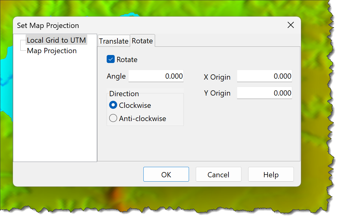
▪Angle
▪X Origin
▪Y Origin
▪Rotation direction
•Use the Define Map Projection Window to define UTM Map Projections.
Notes: 1.Coordinates are translated before being rotated. |