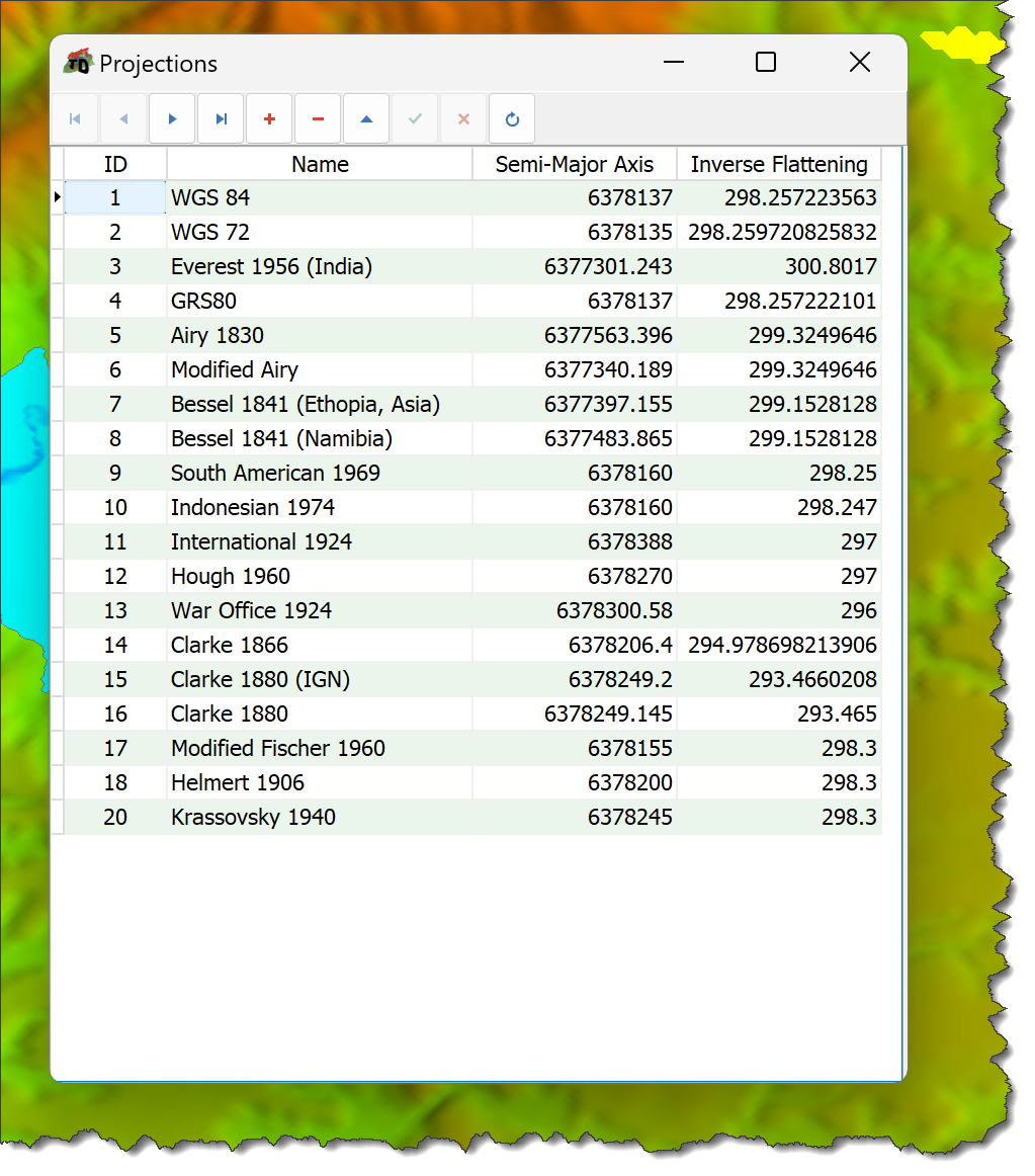
Rift TD stores Map Projection data in a database that is distributed, and installed, during installation.
The database includes a number of built in UTM projections.
If required, define additional UTM Projections.
To define a UTM Projection:
•Click Survey > Map Projections.
•Parameters comprise:
oProjection ID: Unique number for the projection.
oProjection Name: Projection description.
oSemi-major Axis.
oInverse Flattening.