The Incremental Volume Window displays volumes and areas as a function of elevation.
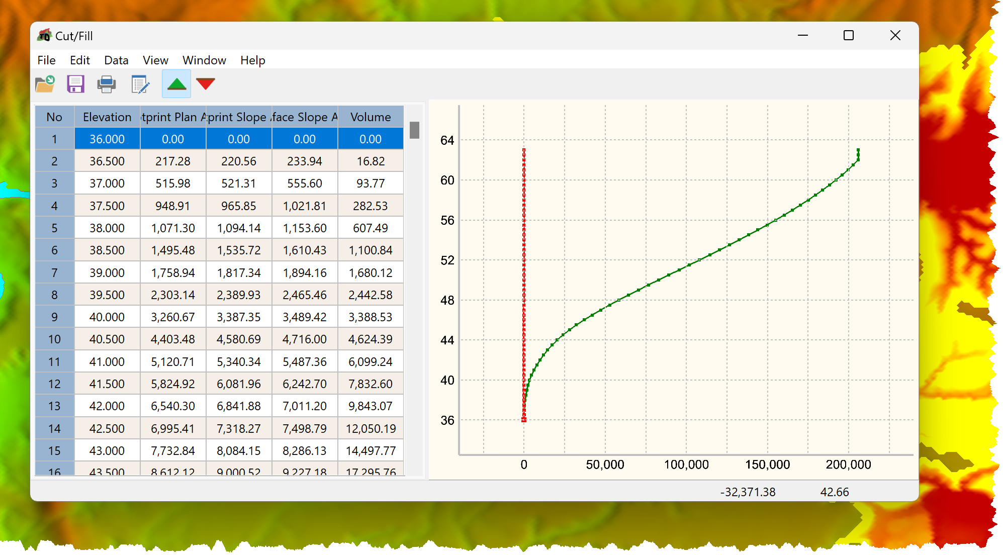
Output comprises:
•Elevation
•Footprint Plan Area
•Footprint Slope Area
•Surface Slope Area
•Volume
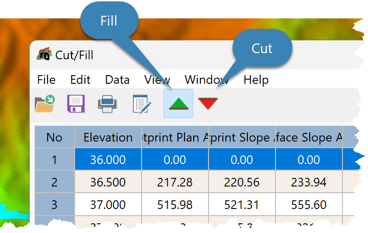
To display cut or fill results use the Cut Button and the Fill Button.
To hide or show the cut or fill curves:
•Activate the cut or fill results on the Data Grid.
•Right click on the Data Grid.
•Click Visible.