There are three profile types:
Assign the profile type on the Profile Type Dialog when adding a new profile.
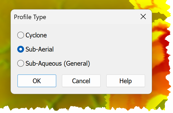
By default, two profiles are automatically generated:
•a sub-aerial profile; and a
•sub-aqueous profile.
During modelling, one or more profiles are combined to form a Complex Profile that extends from the Beachhead to the Pond.
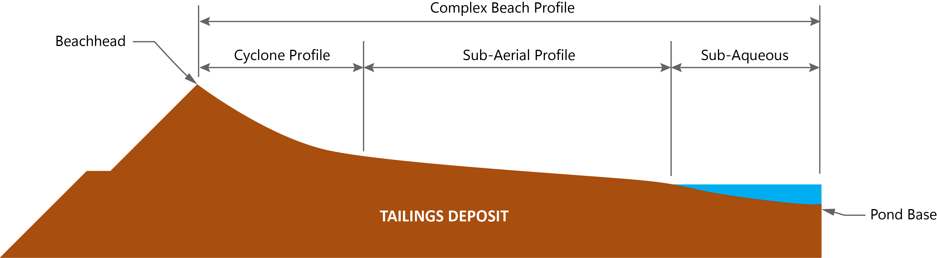
Cyclone Profiles are only used for upstream cyclone deposition.
Their upstream extent is defined by a Deposition Point.
Their downstream extent is either defined by:
•A specified underflow percentage; or
•Its intersection with surface topography if the specified underflow percentage cannot be achieved.
Sub-aerial Profiles define the beach shape above the pond.
Their upstream extent is defined by:
•Deposition point; or a
•Cyclone beach downstream extent.
Their downstream extent is defined either by:
•The pond elevation; or
•Its intersection with natural topography if it intersects the surface before reaching the pond elevation.
General (Sub-Aqueous) Profiles
General (Sub-aqueous) Profiles define either an entire beach profile, or the final, sub-aqueous, section of the beach.
Their upstream extent may be defined by:
•The Deposition Point if the profile defines the entire beach profile; or
•The downstream extent of a Sub-aerial Profile; or
•The downstream extent of a Cyclone Profile if the Cyclone Profile extends below the supernatant pond.
Their downstream extent is defined by the profile's intersection with topography.
Note A General (Sub-aqueous) Profile can define the entire sub-aerial/sub-aqueous beach profile; define it as the material's sub-aerial profile when defining a Complex Profile. |