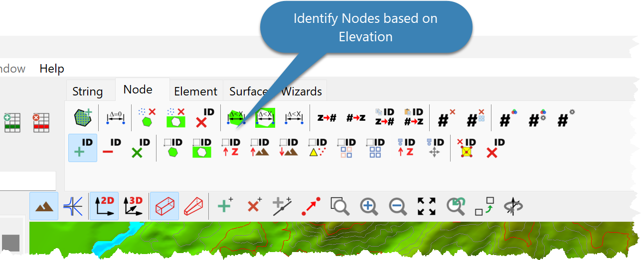
To identify Nodes based on their elevation:
•Click Surface > Nodes > Identify and Manipulate > Identify > Elevation; or
•Click the Identify Nodes Elevation Button.
•Select an option:
•Elevations less than an specified value.
•Elevations in a specified range.
•Elevations greater than an specified value.
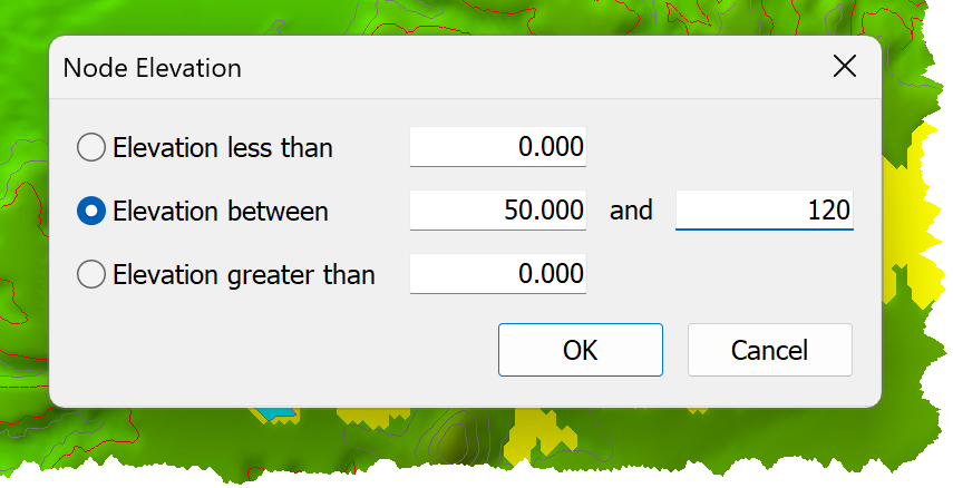
•Click OK.