To set or adjust Node elevations:
•Right click on the Data Grid.
•Click Set Node Elevations.
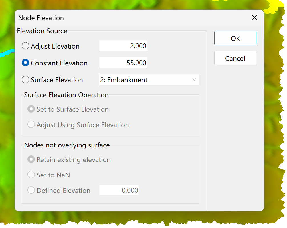
•Select an operation:
oAdjust Elevation: Node elevations are adjusted by the specified value.
oConstant Elevation: Node Elevations are set to the specified elevation.
oSurface Elevation: Set the Node elevations using a specified surface:
▪Select a Surface from the List Box.
▪Select an Elevation Operation:
•Set to Surface Elevation: Nodes are set to the Surface elevation.
•Adjust Using Surface Elevation: The Surface elevation is added to the Node elevation.
▪Select an option for Nodes not Overlying the Surface:
•Retain the existing elevation.
•Set to NAN (Not a Number): Node elevation is made invalid.
•Defined Elevation: Elevations are set to the specified elevation.
•Click OK.